The Salish Sea Map: How Cartography Contributed to the Adoption of the Name Salish Sea
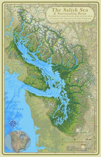
The Salish Sea & Surrounding Basin - Stefan Freelan, 2009
Archived video recording of this talk.
Cartographer and geographer Stefan Freelan will discuss the process of the “Salish Sea” becoming recognized as an official name and the role that his map, The Salish Sea and Surrounding Basin, played in this process.
Maps help us to better understand our environment. They also serve political and cultural agendas. The Salish Sea map was created both as an educational aid and as a part of the naming campaign. In this talk Stefan will explore the choices and creative process that went into the creation of the map, why the map is the way it is and how it’s different from other maps of the area, and how the map contributed to the name adoption process at both the grassroots and governmental levels.
About the Speaker
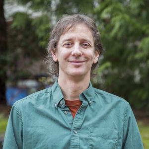
Stefan Freelan began sailing the Salish Sea as a teenager and has chosen to call the seashore home ever since. He is Assistant Director of the Spatial Institute at Huxley College of the Environment at Western Washington University and teaches courses in GIS (Geographic Information Systems), GPS (Global Positioning System) and Cartography. In 2008-09 he created the Salish Sea and Surrounding Basin map for Bert Webber as part of the (successful) campaign to get the name ‘Salish Sea’ officially recognized by the governments of Washington, British Columbia, Canada and the USA.
---------------------------------------------------------------------------
Links for more information:
Download the Salish Sea & Surrounding Basin map.
Return to the Salish Sea: Mapmaker Stefan Freelan (KNKX, 2017)
---------------------------------------------------------------------------
From Bert Webber:
Videos:
- Official Naming of the Salish Sea (Coast Salish Gathering, 2010)
- The Salish Sea: What's in a Name (Wilson Library, Speaking of Maps, 2016)
- The Salish Sea (Whatcom Historical Society, 2018)
Audio / Radio:
- Return to the Salish Sea: Visionary Bert Webber (KNKX, 2017)
- Visionary Bert Webber: "Good Science is Stewardship" (KNKX, 2017)
Written Account:
- How the Salish Sea Got Its Name (Bert Webber, SeaDoc Society)
---------------------------------------------------------------------------
More on the Ish River Country map.
---------------------------------------------------------------------------
The Salish Sea Atlas (Dr. Aquila Flower, et al)
Building a Digital Atlas of the Pacific Northwest (video, Wilson Library, Speaking of Maps, 2017)
---------------------------------------------------------------------------
Environmental Speaker Series
The Environmental Speaker Series is hosted by the College of the Environment at Western Washington University.
The Series is free and open to the public. Talks are held each Thursday at 4:30 pm in Academic Instructional Center West room 204 - AW-204. Talks will also be streamed via zoom. Register with the Alumni Association for the zoom link. Paid parking is available in lot C.
Learn more about the Environmental Speaker Series
Subscribe to the Email List